Pocket Elevation Surveyor


This app surveys the elevation of 120 points of a grid centered on a
remote map location chosen by the user, or their actual GPS position.
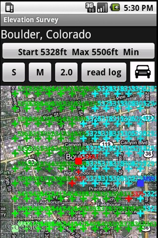
All points downhill from the observer are shown in blue,
uphill points in green. The lighter the shade of blue, the higher the
elevation. The darker the shade of green denotes lower elevation.
Other points about the same elevation as the observer are
marked
in red.
The elevation survey can be done in three scales, small,
medium *the default) and large. The scale can be changed by clicking the
chosen S, M, or L button before the survey begins.
The grid for the small setting is about 1/2 mile x 1/2
mile
for an area of 1/4 square mile. The default medium setting is about a mile
wide and a mile tall, with an area of about 1 square mile. The large
setting is about 2 miles to a side with an area surveyed of about 4 square
miles.
Surveys can be for a remote location or actual GPS position.
The remote option calculates the elevations around a point
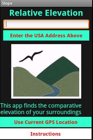
selected om the map. Enter the address into the Edit Box, perhaps by using
the Voice Input feature, and then wait a moment while the geocoder
searches for the latitude and longitude coordinates of that location. The
app will then zoom to a map centered on the location you specified.
The GPS option allows for surveying around one's actual
position.
When the map is centered properly and the scale is
selected, then click the begin button at the top. Completing the survey
may take a minute or two.
The icon on the right that looks like a car
toggles
between the satellite view and the road map view. It may be easier to read
the elevation values with the road map view selected.
The result overlay also marks the highest and
lowest
points within the area surveyed by green and blue squares respectively.
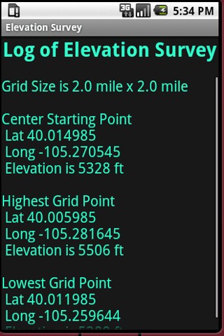
After the survey is completed, you can click the
Read
Log button to see a brief summary of the results.
The app currently only works for the USA and not for Canada or
elsewhere.
For the app to be zoomed to one's actual location, the phone
Location
settings must have Satellite enabled. Establishing the GPS satellite
connection may take a moment or two. The app will not run in the real
location mode until the connection is stable.
After you are finished using the app, it is a good idea to turn
off
the Satellite tracking because uses up the battery faster.
GEONOTE AND OTHER
UPCOMING APPS


