Solar Times
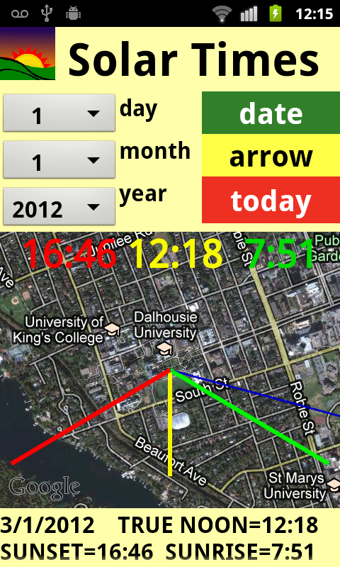
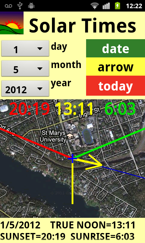
The Solar Times app automatically calculates the time of sunset
and sunrise, and also true noon, from any location.
The angle of sunset and sunrise are drawn on the map. Sunset is
shown in green, sunset in red. The yellow line points to south, and represents True
Noon.
The are four ways to use the app.
1) Pressing Today and leaving the map centered at the cross: gives
the results for your current location for today. This is the main intended way
to use the the app.
2) Sliding the map and then tapping Today: gives today's results
for another location.
3) Selecting a date using the three drop-down menus at the left
and then tapping Date, without sliding the map: gives the result for the selected
date at your current location.
4) Selecting a date using the three drop-down menus at the left
and then tapping Date, after sliding the map to another location: gives the result
for the selected date at the selected location.
The middle button called Arrow displays a yellow arrow, which
points in the direction the phone is aligned. This is handy for identifying the
solar angles in relation to your present position.
Muslim users may be interested in True Noon for scheduling midday
Dhuhr Prayer. There is a thin dark line leading from your present location in
the direction of Mecca. The yellow arrow can be aligned with this line.
Note: The Solar Times app uses the phone's Last Known Location
setting. So if you turned off both the Use Wireless Networks setting and the Use GPS
Satellites option. and you have turned off your phone since then, then you
will need to re-enable and establish a new location before the app will
work.
COLOR MATCH AND OTHER APPS