Mansions in
Montreal's Golden Square Mile
INSTRUCTIONS ON USING THE APP
The opening page of the app has five icons which when clicked lead
to various types of background reference material.
HOMES
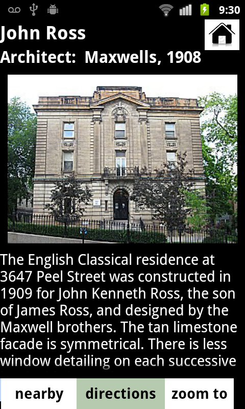
The first icon points to a page with all the homes
listed. They can be searched by name, address, street or architect.
STREETS
The second icon points to a list of the streets in the
Square Mile where the homes are located.
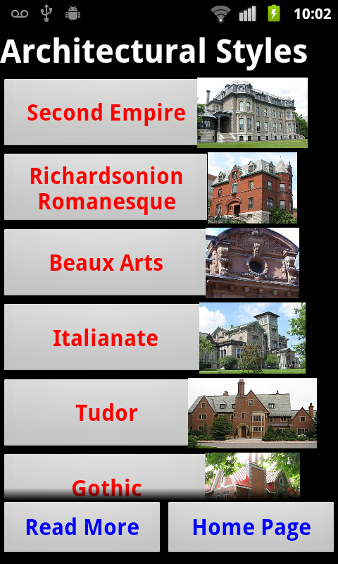
STYLES
The third icon directs to a listing of the early
architectural styles represented in the Square Mile.
ARCHITECTS
The fourth icon leads to a list of the important
architects. For each architect there is a brief discussion and a
scrollable slideshow of the homes designed by them.
GLOSSARY
The fifth icon clicks to a visual glossary of
architectural features present in the Square Mile mansions. These features
are mentioned in the home descriptions and help with the identification of
architectural styles.
Below the five reference icons, there are two buttons. The upper
one leads to this instruction page.
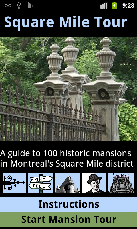
The bottom button Start Mansion Tour leads to the important map
page of the app. Tapping the image of the gates also leads to the Map
Page.
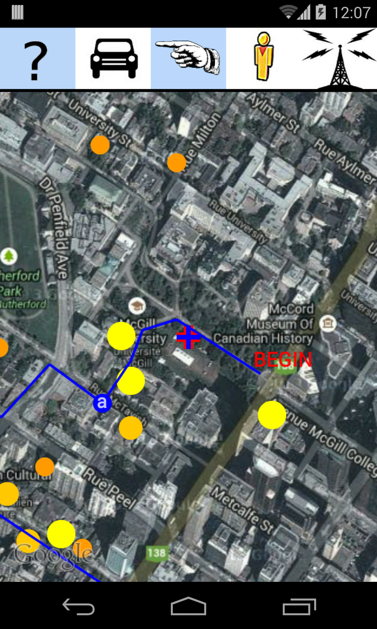
THE MAP PAGE
The Map Page opens at a location centred at
the front gates of McGill University on Sherbrooke Street. By default the
map is in satellite view and resembles an aerial photograph. The yellow
circle dot below the centre of the map represents the site of one of the
mansions. The color and size of the circle indicate the significance of
the home. The most important are marked in larger yellow circles followed
by slightly smaller yellow circles for the next tier of homes. Lesser
homes are marked in orange and minor homes in red. Clicking exactly on a
circle causes the mansion name to appear in red letters.
There are six new icons on the Map Page:
DESCRIPTION OF NEAREST SITE
The Question Mark icon brings up the description page for the closest
mansion to the map centre. If it clicked a second time, the next closest
house is described, and so on.
TOUR SHOWN
Clicking the Strolling Man icon causes a recommended
walking route to be displayed in blue. The icon changes to a Pointing Hand
at the same
time. Clicking it a second time removes the blue route from the map.
STREET VIEW
The small Yellow Man icon brings up the Google Street View for that
location, assuming that it exists as the views apply only to a narrow
strip along some, but not all Square Mile streets. (Redpath Crescent, for
instance, does not yet have the Street View recorded.)
ROAD MAP
The Auto icon switches to a simpler map showing the streets but
lacking the photo satellite view. The auto icon then switches to a blue
globe icon. Clicking this globe returns to the default satellite view.
Similar to the option on Google Maps, this button toggles between
a satellite view and a road map view. The default setting when you begin
the program is of the satellite view.
TURN ON GPS
The important Radio Tower icon brings the centre of
the map to align with your actual location. This Tower icon must be
activated in red for the route mapping (the footprint icon) and also for
the nearest mansion query (the question mark icon at the upper left) to
work properly.
Before this feature will work properly without crashing the app,
the phone needs to have established a connection with the GPS satellite
signal. Before starting the app, you must check your settings on the main
phone page to make sure that the Location is set to use GPS satellites.
Establishing an initial connection may take a moment or two. You can look
for the Android icon that resembles a satellite receiver dish along the
top edge of the screen. Or open the built in Google Maps application to
see if the location is known. It will display as a blue triangle in the
center of the Maps screen as soon as a connection is established. After
this occurs, all aspects of the Square Mile Mansion Tour app should work
just
fine.
COLOR MATCH AND OTHER APPS