Pocket Surveyor
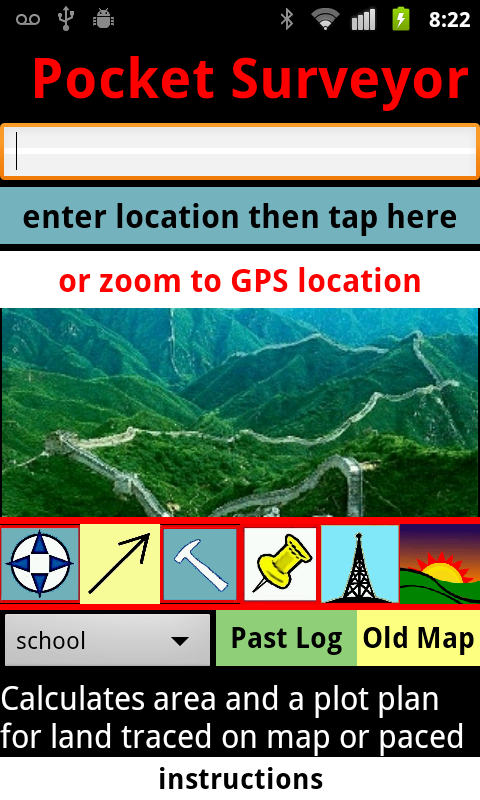
The app calculates area and perimeter and creates a rough
'metes-and-bounds' property description, similar to a plot plan, for irregular-shaped properties which are traced on a map or
paced. The bearing of each edge is shown.
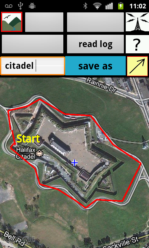
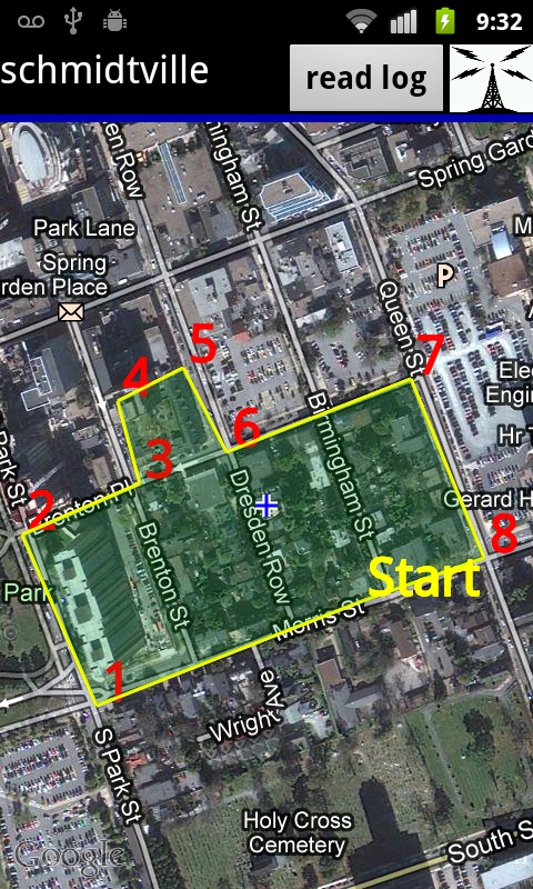
The app can be used 'in the field' using GPS locations to tag
corners, or used remotely to quickly construct an approximate plot description without
visiting the site.
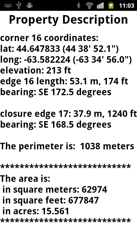
The resulting property description shows the lat/long coordinates
and elevation for each corner, and the length of each edge and its bearing in
decimal degrees from True north. The elevation of each corner can (optionally) be recorded.
Maps and property descriptions from past surveys can be stored on
the SD card and retrieved later from a dropdown menu.
The app can be used to help find a lost corner based on a survey plan, or else to check which side of a known property line that you happen to be standing.
The are several other built-in tools.
The Thumbtack icon on the landing page leads to the GeoNote
feature, whereby a short verbal comment or typed message message is sent
automatically to a preset home email address. The email shows the exact
coordinates where the note was taken and also a link to a Google Maps page
where this location is tagged by a green icon.
Before the GeoNote feature will function, you must preset your
recipient email. Setting your email need only be done once, not every time you use
the app.
If you set the recipient email for GeoNote to another
phone running the app, then two people can keep in touch of the other's location in
urban or wild locales.
The Compass button leads to a screen which shows bearing in relation to True
North and also has a digital level.
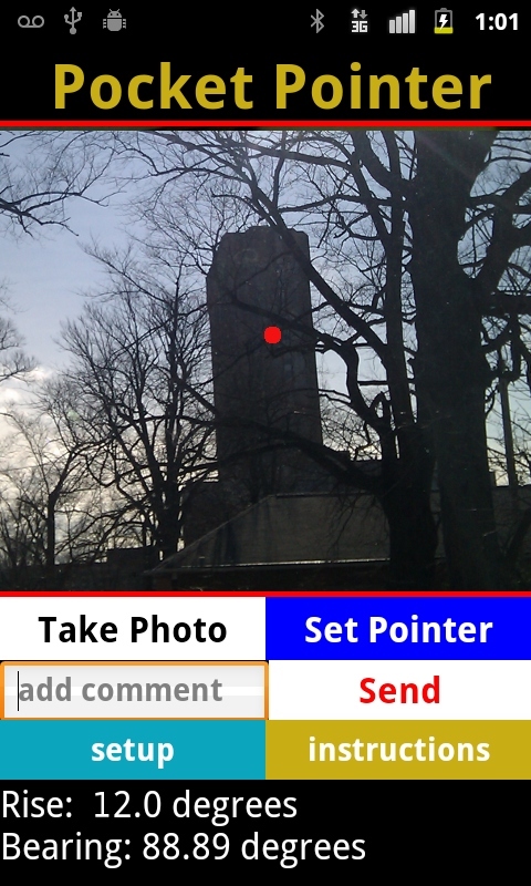
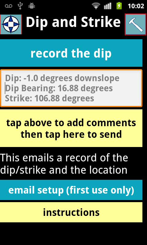
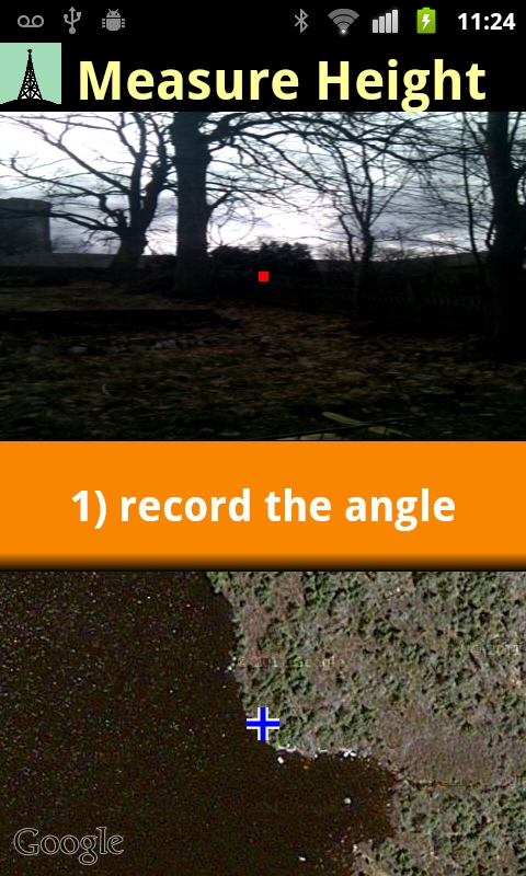
Other tools record geological dip, estimate height of distant
objects, or record an alignment to a point targetted in the camera viewfinder.
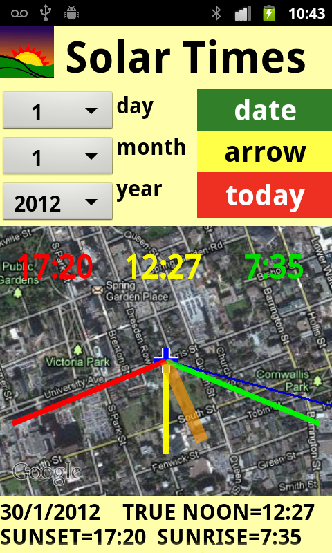
There is an option to calculate sunset, sunrise and True Noon times and view their alignments on the map.
An arrow shows phone angle relative to these alignments.
This app needs a fairly large touchscreen, preferably 3.7 inch or more.
If you are using the app at on-site, the Location setting of your phone should be temporarily set to Use
GPS Satellites. (The default setting is Use Wireless Networks.) The Use GPS Satellites setting uses extra battery
power and requires a clear view of the sky and takes several minutes to establish a connection.
COLOUR MATCH AND OTHER APPS